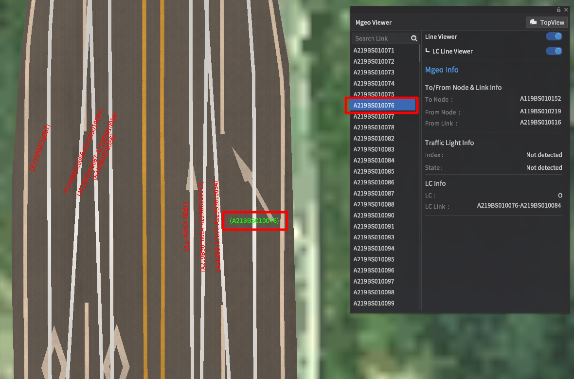
MGeo Viewer
Using the MGeo Viewer
The MGeo Viewer overlays the underlying map data into the main scene, allowing users to examine the geometries of road network links, their associated IDs, and how they connect to other links.
MGeo is the map data format for all geospatial and road network data prebuilt into MORAI SIM. (Imported data may follow other data models, but are converted internally for display purposes)
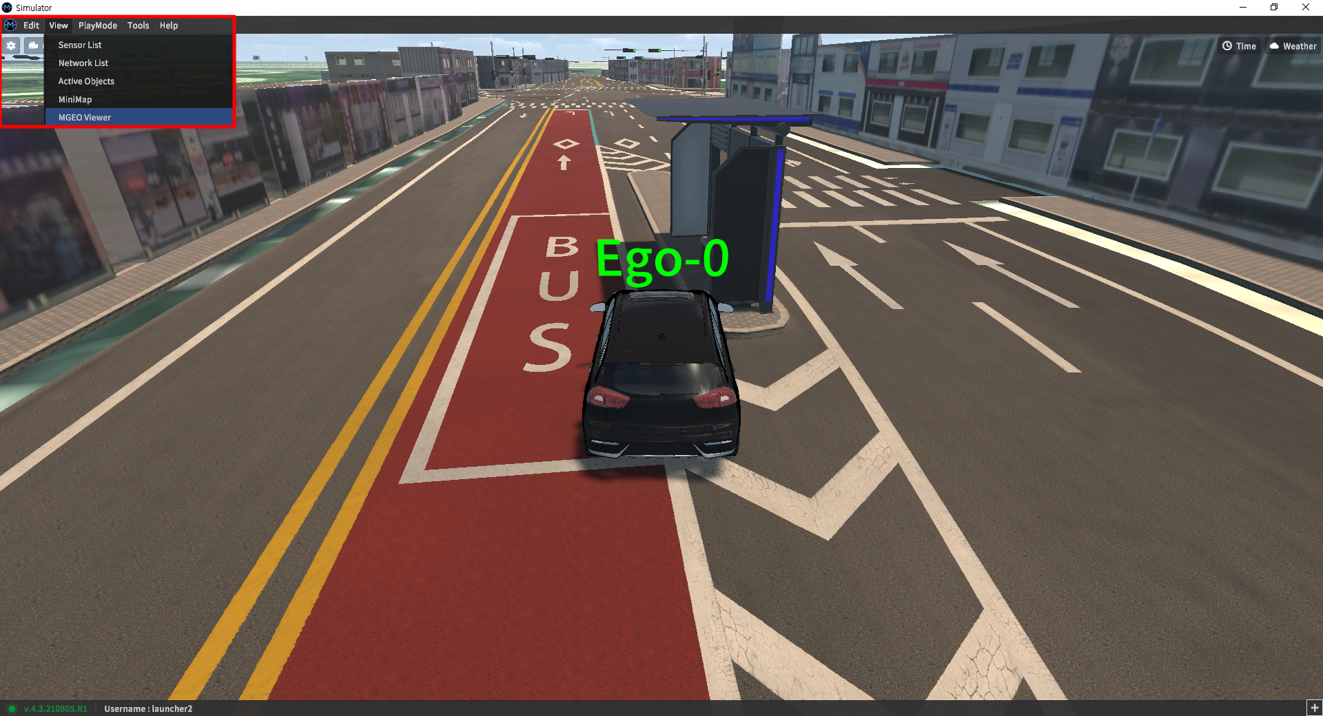
Access the MGeo Viewer from the main menu bar. Go to View >> MGEO Viewer to bring up the dedicated UI.
MGeo Viewer Details
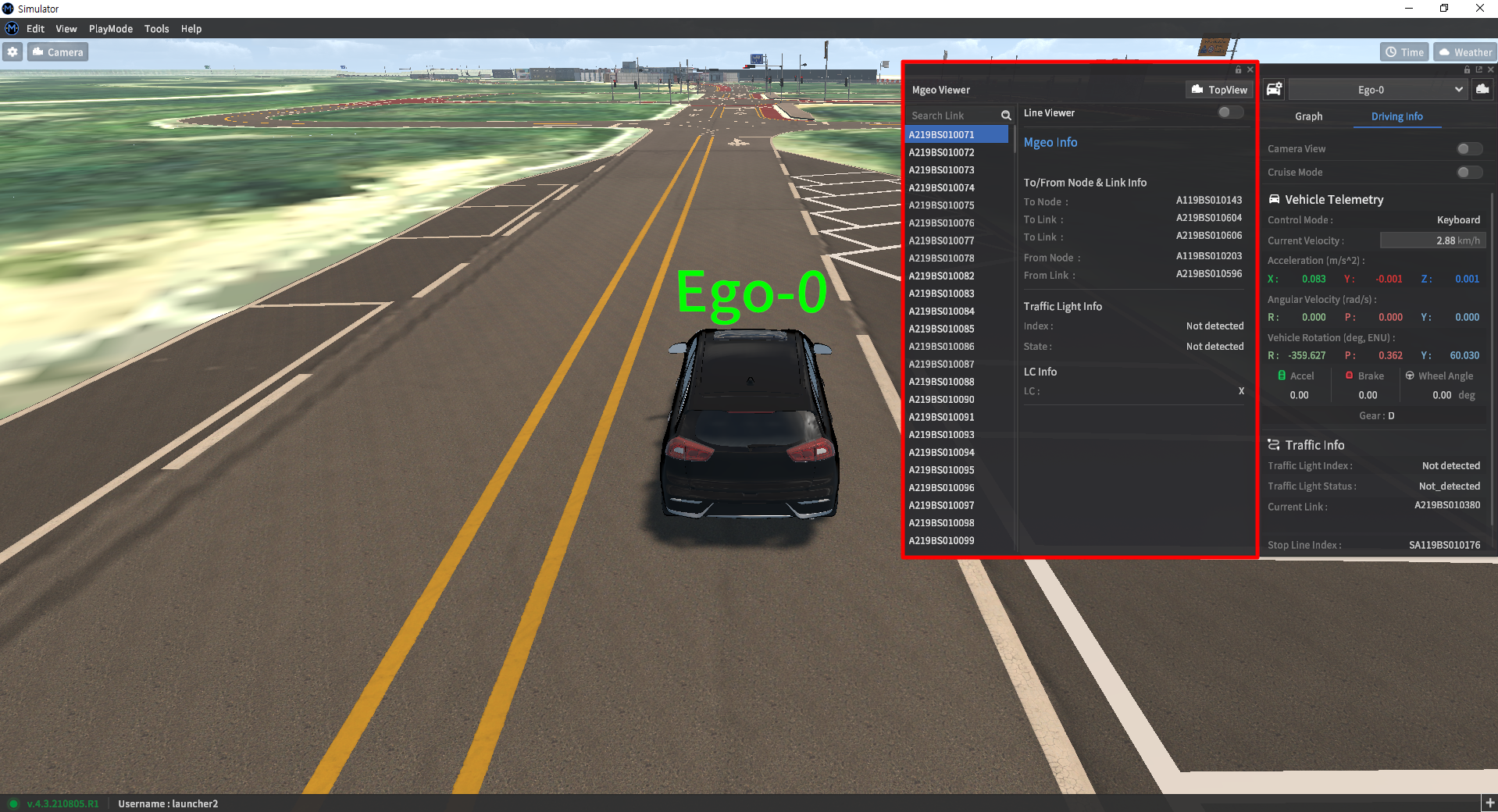
The MGeo Viewer window lists all links loaded into the map on the left, and displays detailed information on any selected link in the details pane on the right.
There are three different modes that can be enabled separately from this window: Line Viewer, Top-down View, and LC Line Viewer.
Line Viewer
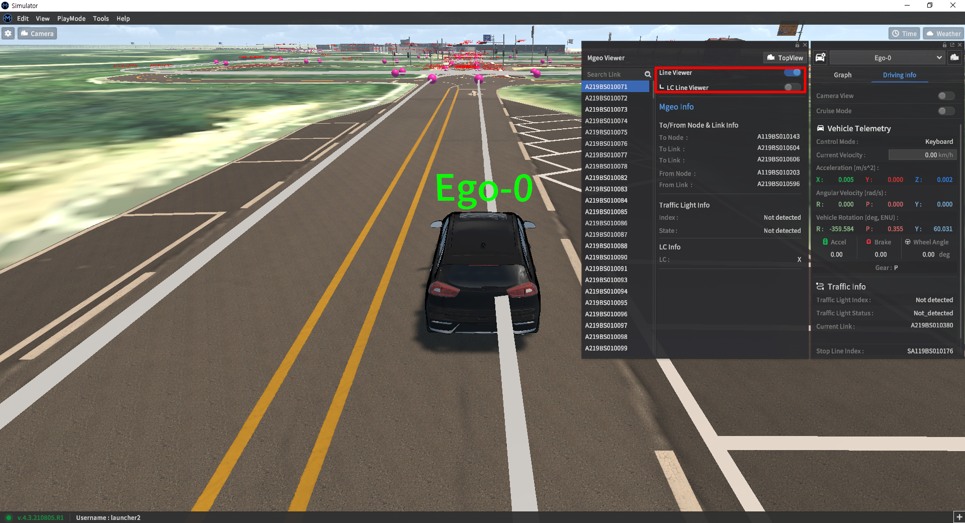
By default, the MGeo Viewer does not immediately show lane links in the scene. Activate the Line Viewer option in the upper part of the pane to enable visualization. Unselected links have their IDs displayed in red, whereas any selected links have their IDs shown in light green.
Top-down View
Once a link is selected, clicking the Top View button in the upper right corner of the MGeo Viewer window will switch the camera to a top-down view.
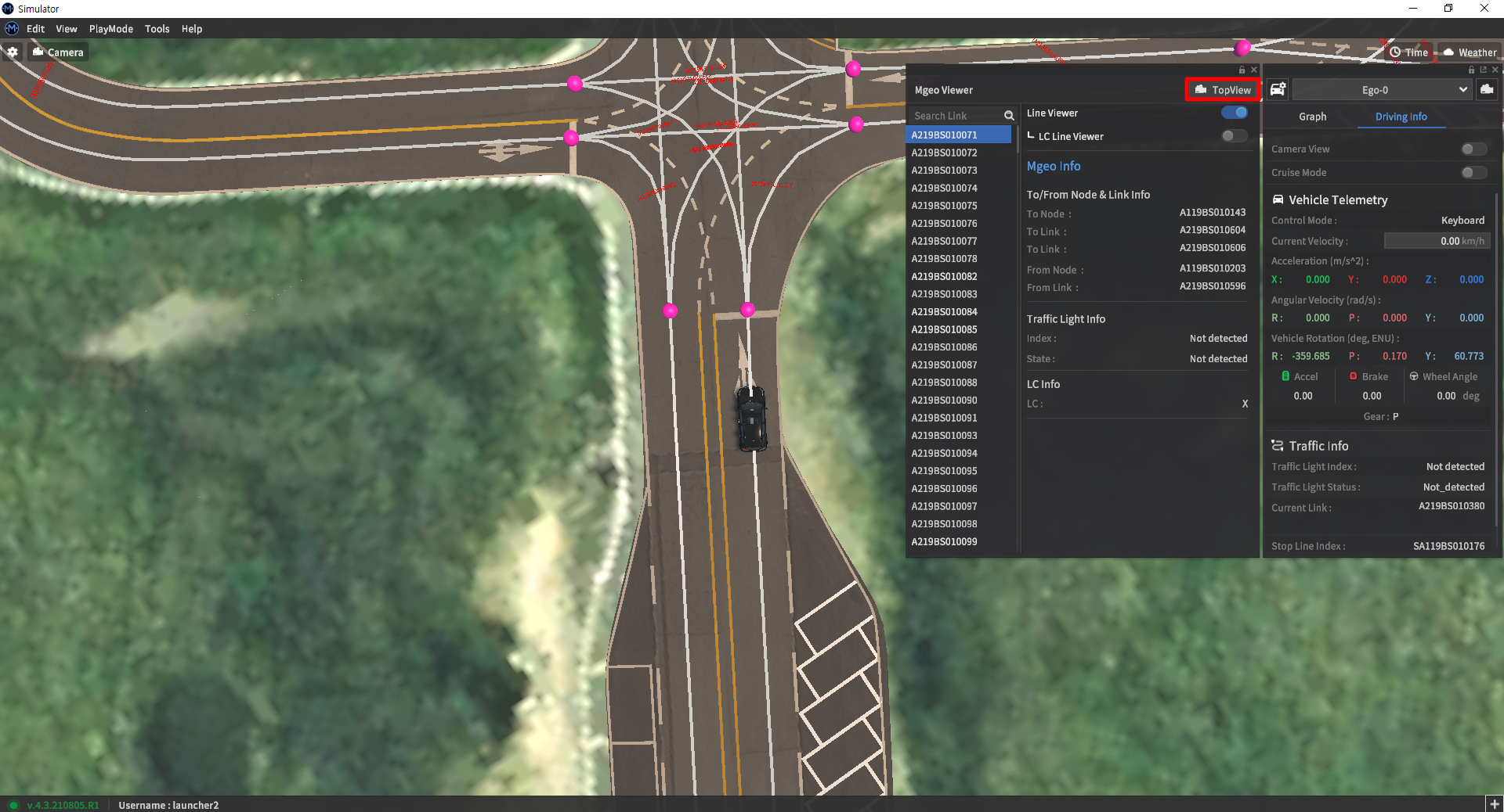
Visualizing lane-change lines
Lane change lines are lines between nodes that lie on different lanes within the same road. These lines indicate whether a lane-change maneuver is possible, and are the lanes along which NPC vehicles will attempt to make such maneuvers.
To add lane change lines to the MGeo Viewer, activate the LC Line Viewer button after activating the Line Viewer option.
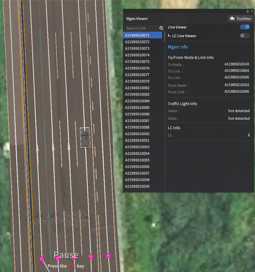
LC Lines Off
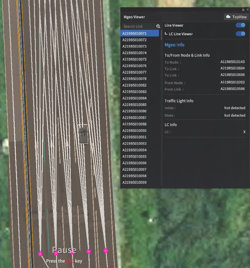
LC Lines On
Search Function
The search bar allows users to find specific MGeo lines by ID. Clicking on a listed entry will show detailed information in the right info pane. Double-clicking on the listed entry will move the camera to focus on the selected link.
